(Times of India) After a
week's break, the Met department has said that the rains are back and could
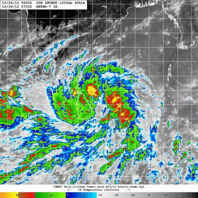
last the whole week. A trough of low pressure over eastern parts of the Bay of
Bengal has developed into a 'well-marked depression' over the Andaman and
Nicobar Islands.
"There is intense clouding over the ocean and our models show that it will
move towards Tamil Nadu,"
said deputy director
general of India Meteorological Department Y E A Raj. This could mean rain from
Sunday night.
"There could be
intense rainfall for the next three to four days, and there could be showers
till the end of the week."
The Meteorological
department has been observing the formation of the system for a week.
"We will have to wait and see before declaring it a depression. We have
not sent warnings to the fishing community as the centre of the system is not
yet clear,"
said Raj. Some parts of Tamil Nadu have started receiving
rain.
"Parts of the Cauvery
delta region, especially Thanjavur and Tiruvarur districts, have reported
rain," he said.
Usually, there are three depressions during the northeast monsoon. Of these,
one hits Tamil Nadu, making October and November the rainiest months. According
to data compiled from 1970 to 2000, Tamil Nadu has received 50% more rainfall
than usual from October 1 this year. While the normal is 150.4mm between
October 1 and 26, Tamil Nadu has received 226mm.
"Going by the history
and the current situation, we are poised for good rainfall," said Raj.
Chennai, in its first week
of the monsoon, received 186% excess rainfall. The onset of monsoon was declared
on October 19, after which Chennai has received 244.2mm of rain. The normal is
85.3mm. Chennai gets about 28cm of rain over 10 days in October and 40cm over
12 days in November. Raj said that in the last five years, the number of
cyclonic storms has come down.
"They have been
replaced by deep depressions," he said.


No comments:
Post a Comment